Roman Milestones: Stone Columns That Counted Miles to Rome
A Roman milestone is a stone column set beside a public road to mark distance. The Latin name comes from milia passum, a thousand paces, which Romans treated as one mile along a highway. Each marker gave the mile number on that road, how far the spot lay from Rome or the nearest major town, and often the names of officials who built or repaired the route. For travellers, armies, and couriers, these columns turned an empire of dirt tracks into a measured network where every league had a fixed address.
Miliaria, stone columns, and the Latin mile
Romans called roadside distance markers miliaria (singular miliarium). They were heavy stone columns, typically about 1.5 m (5 feet) high, carved with Latin inscriptions on the shaft or a attached plaque. The mile they measured was not the modern statute mile but the Roman mile of roughly 1,000 paces, a unit tied to marching soldiers and wheeled supply carts.
A milestone was not a tomb or a boundary stone for private land. It belonged to the public road system and answered practical questions: how far have we come, how far to the next city, and who last maintained this stretch. On major routes the columns appeared at intervals of one Roman mile, a rhythm that let a rider estimate travel time without a map.
From the Via Appia in 312 BCE across the empire
The habit of marking roads in miles grew with Rome's great highway program. The first and most famous of these roads was the Via Appia, the Appian Way, begun in 312 BCE under the censor Appius Claudius Caecus. It first linked Rome to Capua in a famously straight line and was later extended toward Brundisium on the Adriatic coast. Romans called it the Regina viarum, the queen of roads, and it set the pattern for milestones, curbs, and graded surfaces that other routes would follow.
As the network spread, similar markers appeared from Britain to the Balkans and the eastern provinces. Roads were named after the magistrates who funded them, and milestones carried that same pride of office. A column on the Via Domitia in Gaul or the Via Egnatia across the Balkans used the same visual language as one outside Rome: a numbered mile, a distance figure, and an inscription naming authority.
Distance to Rome, magistrates, and road upkeep
Inscriptions on milestones did more than count miles. Many recorded the distance to Rome itself, turning the capital into the zero point of mental geography across the provinces. They also named the consul, emperor, or local official responsible for construction or repair, which made the stone a public receipt for work done with state money.
Road crews resurfaced gravel, reset curb stones, and cleared drains; milestones were reset or reinscribed when a section was rebuilt. According to World History Encyclopedia's account of Roman roads, markers set at regular intervals often noted who was responsible for upkeep on that stretch and what repairs had been made. That detail matters for historians today because a single column can date a road phase more precisely than vague literary references.
Imperial restoration and markers along the Via Appia
Milestones were not permanent in the sense of a single carving. When emperors refurbished old highways, new inscriptions could be added or the column replaced entirely. Along the Via Appia, the road that defined Roman road building from 312 BCE onward, surviving markers include examples with restoration texts from the Flavian period and later. The first milestone on the Appian Way, reset with repair inscriptions under emperors such as Vespasian and Nerva, is now held in Rome's Capitoline Museums, a reminder that these stones were living documents updated as each generation repaved the route.
The practice shows how Roman infrastructure blended engineering with propaganda. A traveller reading a milestone learned both how far he had to walk and which emperor had last guaranteed the surface under his wheels.
The Buzenol milestone in Brussels
A well-preserved provincial example is the Buzenol milestone, now in the Museum of Art History (Musée du Cinquantenaire) in Brussels. Carved in 44 CE, it stood on the Reims-Trier road in what is now Luxembourg and records a distance of 54 miles to Trier. The inscription ties the stone to the emperor Claudius, who expanded and organized road works in the northwestern provinces during his reign.
The marker was found in the remains of a late Roman fortification between Montauban and Buzenol. Its text is typical of provincial miliaria: a place name, a mile count toward a major city, and imperial credit for the road. Unlike the golden milestone at Rome's Forum, which marked the symbolic center of all highways, Buzenol served everyday traffic on a single route through the Rhineland frontier zone.
Stone, survival, and what archaeologists still debate
Most milestones were local limestone or sandstone, carved on site and set in a socket beside the road. Thousands have been excavated or noted in situ; many more were broken up for building stone in the Middle Ages. Scholars use surviving texts to reconstruct route lines, but gaps remain where a road was rerouted and old columns were left standing or buried.
Dating can be tricky when a column carries several layers of inscription from different emperors. Not every mile of every Roman road was marked, and some regions relied on wooden posts that have vanished. What endures in museums and along rural paths still gives a clearer picture of Roman movement than maps alone.
In your scene
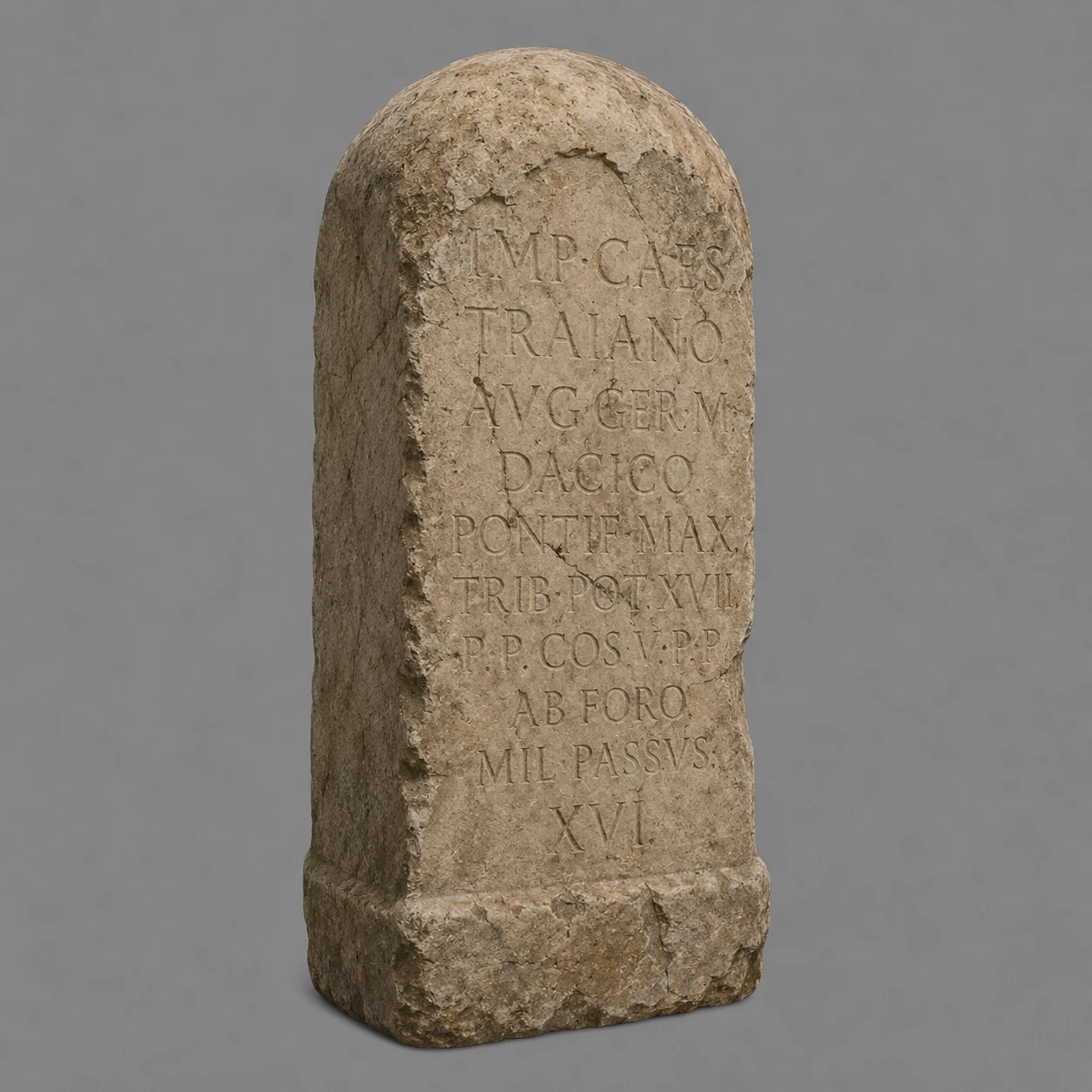
A milestone beside a dirt track or paved cardo instantly reads as Roman territory: the empire measured land in stone as well as in law. Place one where a road bends toward a gate or a small settlement so players see the mile count before they reach the walls. Our Roman Empire Relics pack includes a stylised milestone for roadside verges, forum approaches, and frontier checkpoints.